Trackdyne Documentation
Main ❯ Navigation & tracking systems ❯ AsterGrid: Data brief
 |
 |
|---|---|
| trackdyne.com support@trackdyne.com |
AsterGrid Data brief |
General information
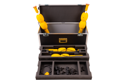
AsterGrid is an underwater acoustic long baseline (LBL) navigation system. The floating long base is formed by four small-sized GNSS-equipped sonobuoys AsterGrid Buoy; with the support of the floating base, an unlimited number of underwater objects equipped with navigation receivers AsterGrid Node, and divers, using the diver’s navigators AsterGrid Nav, can work simultaneously.
System composition
| AsterGrid Buoy GNSS-equipped sonobuoy |
|
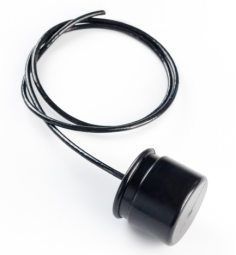 |
AsterGrid Node Universal navigation receiver |
| AsterGrid Nav Diver’s navigator |
The minimum composition of the system includes four sonobuoys AsterGrid Buoy and one receiving device, depending on the user’s task:
- If navigation data must be provided to a diver, the diver’s navigator AsterGrid Nav is used;
- If the location of a remotely controlled vehicle (ROV) must be determined, the navigation receiver AsterGrid Node is used. It is interfaced with the carrier for both power and data, and the data generated by the receiver must be transmitted via the vehicle’s cable to the control console, where it can be displayed in any mapping software that supports the connection of standard GNSS receivers (GGA, RMC and MTW sentences).
Tasks to be solved
- Simultaneous determination of the 3D geographical position by an unlimited number of underwater objects (divers, ROVs, AUVs, etc.);
- Recording the movement tracks of divers;
- Pre-loading of waypoints, navigation to the loaded points, saving (marking) the current position of the diver;
Distinctive features
- Working in absolute geographical coordinates;
- A floating base of four sonobuoys is enough for the operation of an unlimited number of navigation receivers;
- No preliminary configuration and calibration of the system and its components is required;
- Small size and power consumption of the navigation receivers;
- Emulation of the protocol of standard GNSS receivers for integrated devices
Geometric limitations
Since the AsterGrid system uses modern digital broadband underwater acoustic communication technology, the signals emitted by the buoys have a significant duration (about 200 milliseconds). The buoys’ signals have code and time division, and owing to the finite speed of sound propagation in water and the signal emission period, under certain conditions the signals may overlap each other at the receiving point. There are also limitations related to the physical basis of the operation of a long navigation base.
Therefore, the system has a restriction on the mutual arrangement of the underwater acoustic navigation buoys, and of the navigation receivers relative to the buoys:
- The distance from each buoy to every other buoy must be no more than 700 meters and no less than 30 meters
- The buoys must be arranged in a convex quadrangle, so that its sides are approximately equal and differ by no more than a factor of 2
- The maximum immersion depth of the navigation receivers must not exceed the dimensions of the navigation base
- The highest accuracy of the system is achieved inside the buoy figure, and work must always begin inside this figure. Leaving the figure is possible; however, the accuracy may decrease significantly as the positioned object moves away from the buoy figure